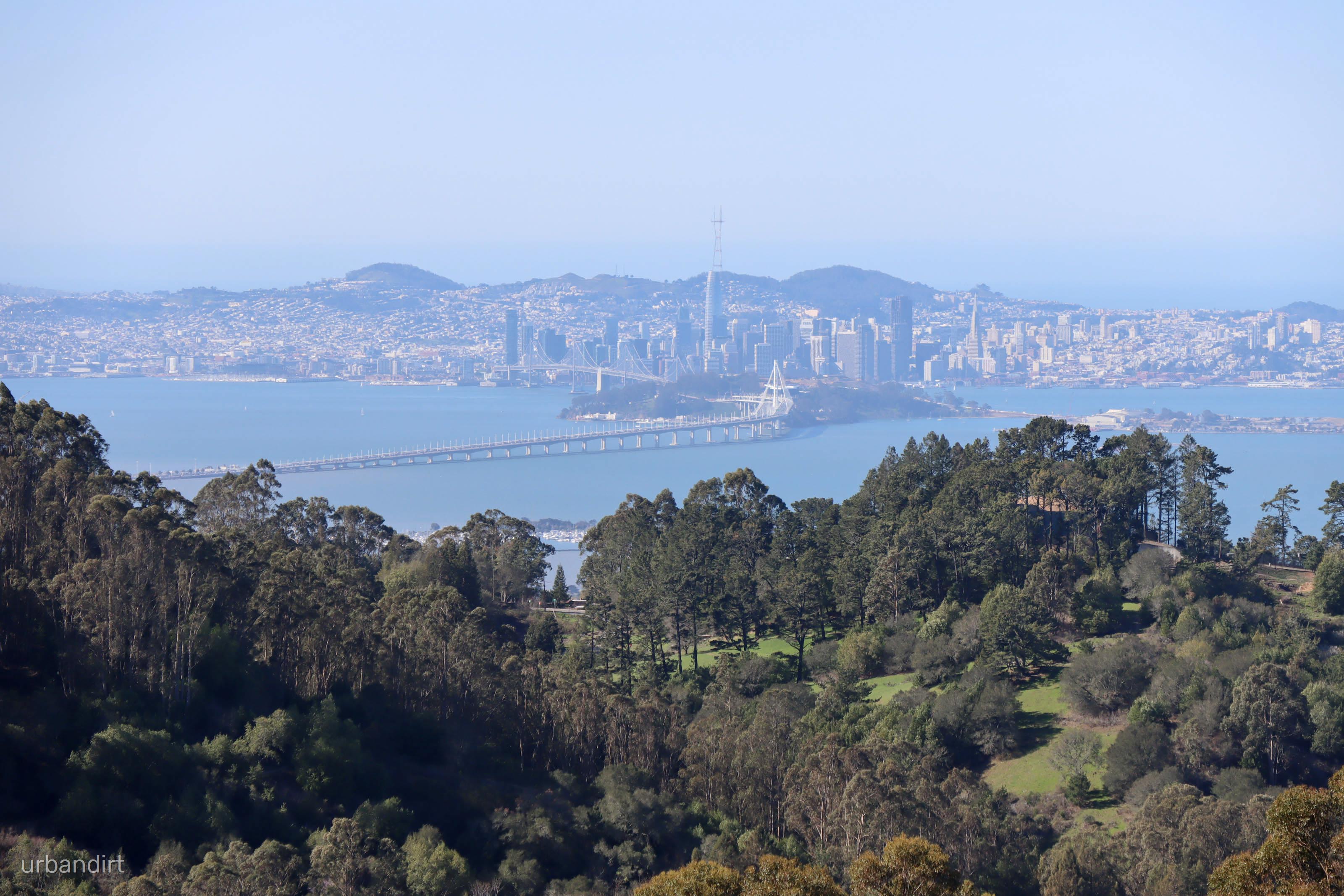
Finish your cup of coffee and pedal uphill on the pavement to reach the ridge of the Berkeley hills. Once you reach the top of Spruce St, you’ll dip into Tilden Park on the road, and then begin your first dirt section. The start of the dirt climb up Meadows Canyon trail is moderate, but becomes much steeper when you cross the paved Wildcat Canyon Road and begin the climb up Seaview Trail. Seaview can be loose and steep - it’s a real bear of a climb. After two and a half miles of climbing, you’ll reach the highest point of the route, and be rewarded with awesome views of the bay.
Seaview begins to descend towards Vollmer Peak, where the route transitions back onto pavement. Hang a left onto Grizzly Peak Boulevard and then descend to the corner of Grizzly Peak and Fish Ranch Road. Enjoy one of the best paved descents in the East Bay hills! At the four-way stop, turn left and continue down the very steep Fish Ranch Road. You’ll cross over the top of the Caldecott Tunnel and head into Sibley, climbing up the Skyline trail, back up to the ridge.
When you see the busy parking lot at Skyline Gate, turn off and hop onto East Ridge Trail. This dirt section is relatively wide, and has high hiker traffic at the beginning. The trail soon narrows and meanders through beautiful oak groves. At a fork in the trail, you’ll turn right onto Canyon Trail and descend steeply towards Redwood Road. Pass through the trailhead, turn right onto Redwood, and peel off at the Big Bear Staging area, where you’ll commence another dirt climb. The climb up MacDonald Trail is rough and steep, but after the technical bits, the rest of the climb is straightforward (but still hilly).
You’ll continue south on some wide fire roads and rolling hills, on trails through the oak-forest. There’s a secret singletrack on your left when you’re headed down MacDonald - it’s a blast! Emerge from the dirt onto Skyline Boulevard and head back north. On the asphalt, you can relax your mind and simply pedal until you get to Joaquin Miller Park, which has a last little bit of dirt singletrack. Or you can ride the trail in the median of Skyline, which is a ton of fun on a gravel bike. Turn into Joaquin Miller and hit Sunset Trail. It’s mild and easy, and also has some nice views of the bay.
Exiting the dirt, you’ll sail downhill on pavement to Montclair Village. Head through the village and cross under Highway 13, where you’ll reach Lake Temescal and take the multi-use path through the park. Drop into Rockridge, zig-zag across Berkeley, and you’ll eventually arrive at your post-ride beverage!


